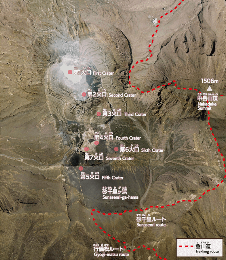
Sunasenri-ga-hama and the Surrounding Area
At 1,506 m above sea level, Nakadake is Mt. Aso's second highest peak after Takadake (1,592 m). Nakadake is an active volcano with seven craters on its summit. It is flanked on the west side by a creater floor covered by fine black sand of crumbled volcanic rocks, called Sunasenri-ga-hama. The area is a barren landscape with high volcanic gas levels in which few plants can grow.
Of the seven craters of Nakadake, Crater No. 1 is unique in that visitors can approach the crater and observe the acidic blue pond that has formed there. The color is produced by dissolved volanic minerals. The temperature naturally remains at around 60℃, increasing during periods of volcanic activity. Crater No. 1 constantly discharges volcanic gases and is under continuous surveillance. The gas is mostly composed of water vapor. However, levels of hazardous substances, such as sulfur dioxide, can change from minute to minute and, on particularly active days, can reach dangerous levels without warning. For this reason, access is limited to ensure visitors' safety. It is recommended that people with asthma, or cardiovascular or heart disease, do not approach the Nakadake area. Visitors who do approach the crater area must stay away from restricted zones, pay close attention to announcements regarding volcanic gas emissions, and follow all instructions by crater monitors during an emergency.
The remaining craters are inactive and made up of volcanic rock: pumice, scoria (a pumice-like rock created by the hardening of gaseous basaltic magma) and welded tuff (a hardened rock created from the heat and pressure of a pyroclastic flow). Much like Sunasenri, the area is covered in volcanic ash and debris.
Major geosites
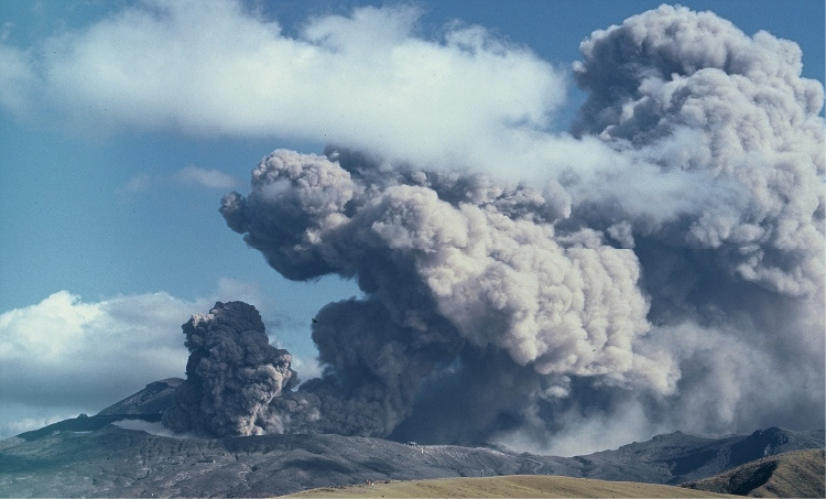
Phreatomagmatic eruption
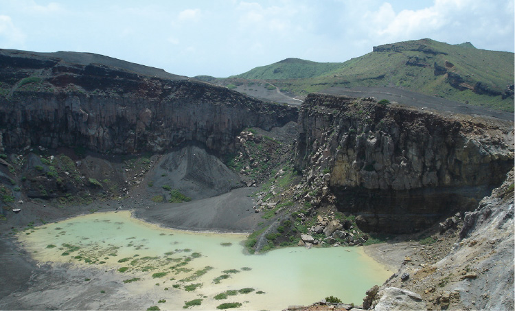
West side of the first Crater
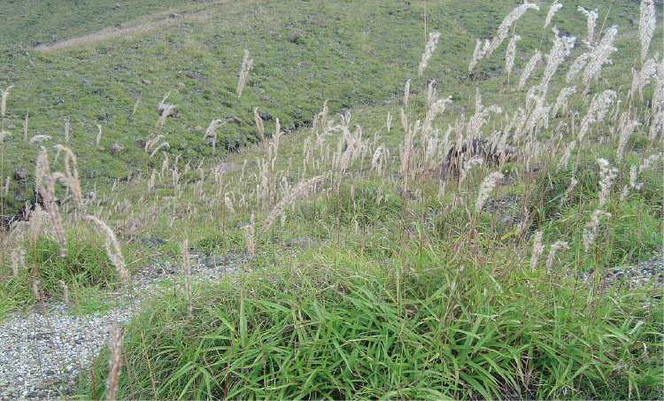
Miscanthus oligostachyus
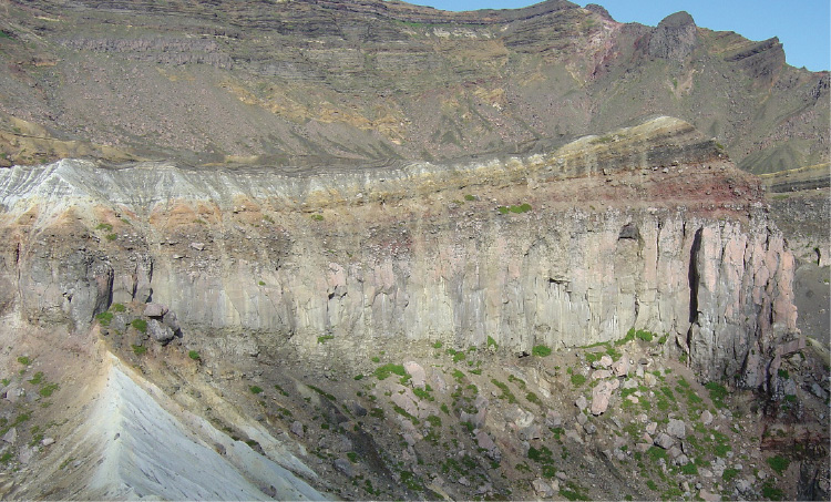
East side wall of the fourth crater
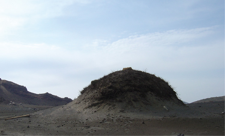
Small Sandy Hills with Growing Japanese Knotweed
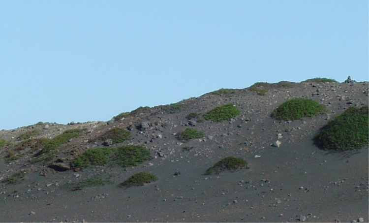
Growing Japanese Knotweed
Guide Map